
Creating a User-Friendly Zoning Code
October 7, 2026
by
Steve Butler
Category:
Development Regulations and Zoning
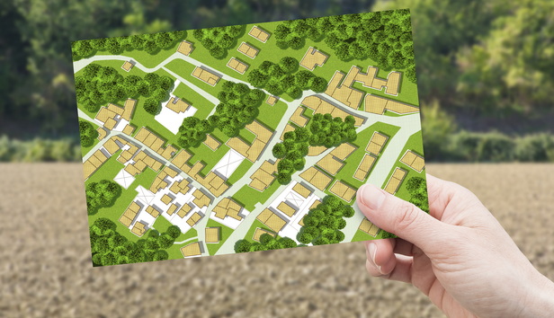
Zoning codes play an important role in shaping and maintaining how a community looks, feels, and works, from a physical development perspective. Zoning can be used to promote a community’s vision for the future, sustainable development patterns, diverse housing options, economic vitality, many transportation options, and overall health and safety.
Zoning codes are the documents that contain zoning standards and procedures related to achieving the aforementioned objectives. An important complement to a zoning code is the official zoning map. A local zoning code and map take much of its direction from the local comprehensive plan (and its future land use map), and the Growth Management Act (GMA) mandates that all three (code, map, and plan) be consistent with each other.
To paraphrase a quote from JCShepard.com: “A great [comprehensive] plan sets the direction; a [great] zoning code makes it possible.” However, a zoning code will not be as effective in achieving this objective if it is not easy to navigate and use.
This blog article is the first in a two-part series with a focus on how to create a user-friendly zoning code, including plenty of examples.
A Quick Primer on Zoning
What is zoning, you may ask. Generally speaking, zoning is a regulatory mechanism that identifies what can and cannot be done on a piece of land. Zoning codes are documents that contain zoning categories, associated development standards, and procedures.
A zoning code can be a stand-alone set of regulations included in a municipal or county code or part of a unified development code that includes related regulations such as subdivision codes and shoreline master programs. The official zoning map indicates what zoning category applies to each piece of land within a jurisdiction’s boundaries.
Zoning is a powerful regulatory tool that can be used to positively advance a community’s vision. As stated earlier, it is a primary tool for implementing several portions of a community’s comprehensive plan (such as the land use and housing elements).
The connection between the comprehensive plan, the zoning code, and the zoning map is critical. The GMA requires all three to be consistent, but the zoning map and code are what dictate how a piece of property can be used and developed.
Making a Zoning Code User-Friendly
Due to the complicated nature of zoning, zoning codes are often lengthy and complex documents that can be hard to navigate, which is not surprising given the multitude of land use issues that need to be addressed. Given their importance in regulating land uses and implementing the local comprehensive plan, however, zoning codes should be accessible and user-friendly.
Below is a summary of some key factors that contribute to a user-friendly zoning code:
- A clear and understandable organizational structure
- A format that is inviting and easy-to-navigate (including searchable/online versions)
- Companion documents, such as guidebooks and one-page summary sheets
- Navigational tools
This blog will address the first two factors, with the remaining ones to be covered in Part 2 of the series.
A clear and understandable structure
Zoning codes can be either individual, stand-alone codes or included within a unified development code (which usually includes such associated regulations as the subdivision code and the critical areas ordinance).
Zoning codes should have a logical table of contents to help a user to understand the location and flow of the code’s different chapters and sections. The standard organization of a local zoning code in Washington typically consists of these broad categories:
- Purpose
- Definitions
- Land use charts/matrices, including what land uses are allowed in which zones
- General standards common to most types of development
- Special standards tailored for specific types of land uses (e.g., special standards for a downtown zone or overlay district)
- Other miscellaneous provisions (such as a glossary of zoning terms that are not well known to the general public)
The organizational challenge often starts when a user wants to delve deeper into the details. In response, several jurisdictions have prepared guidebooks and other tools (examples of which will be provided in Part 2) to assist users in navigating the table of contents.
An inviting and easy-to-navigate format
Having an online zoning code is becoming more common with Washington’s local governments (with extra bonus points if the code allows users to navigate to a specific section using search terms).
Some general formatting recommendations for increasing the user-friendly look and feel of a zoning code include:
- Well-designed charts, especially for the land use and dimensional requirement sections;
- Use of graphics, drawings, and photos to illustrate complex zoning concepts (which can be challenging to describe or understand when written);
- A multitude of active links, including those that cross-reference other related code provisions; and
- Use of white space and other design features that help humanize the code and associated regulations.
Examples of User-Friendly Zoning Codes
There are many examples of extremely well-formatted and user-friendly zoning codes, provisions, or related documents. Out-of-state examples include:
- Boise (ID) Illustrated Zoning Guide – Explains zoning to the general public and describes the zoning code update process.
- Bridgeport (CT) Zoning Code (2022)
- Buffalo (NY) Green Code (Unified Development Ordinance) (2016)
- Redwood City (CA) Downtown Precise Plan (2024) – Combines an existing conditions assessment, a vision statement, development regulations, and a list of city actions into one document)
- Richmond (VA) Draft Zoning Code (2026)
- South Bend (IN) Zoning Ordinance (2026)
Local examples of Washington State zoning codes and provisions that provide information in an inviting, visually pleasing, and user-friendly manner include:
- Marysville Municipal Code Ch. 22C.080 – Downtown Master Plan Area - Design Requirements
- Ridgefield Municipal Code Ch. 18.206 – Residential Use Standards
The Importance of Up-to-Date Content
Entire books have been written on what should be contained within a zoning code, so this blog will touch only very lightly on this topic.
In general, from a substantive/content perspective, a major zoning code update should have the following key objectives:
- It should align the zoning code with the comprehensive plan (per RCW 36.70A.040(3)).
- It should ensure the local code is consistent with state law (including the numerous planning-related statutory requirements recently signed into state law).
- It should simplify and clarify the zoning code.
Steps to meeting the first objective should be emphasized and incorporated into all stages of a comprehensive planning process. The second and third objectives listed above are relatively self-explanatory. Related to the third objective, agencies should create regulatory language that is clear, easily understandable, and not open to various interpretations (also, be sure to remove inconsistent and outdated zoning provisions).
Vancouver, Washington’s recently updated zoning code and zoning map are excellent examples of a major update process that resulted in the following significant changes:
- 10 new zoning districts were created (replacing 17 previous ones)
- Middle housing is allowed (in all districts).
- Maximum densities are no longer required.
- Density minimums have been increased to drive efficient use of land (while also still allowing for larger/family-sized units by scaling how minimum density is calculated by number of bedrooms).
- Parking minimums have been removed (although the city does now require bicycle/small mobility parking at moderate levels).
- Mixed use is allowed wherever housing is allowed but significantly reduced where commercial is required.
- Land set aside for industry/employment and parks/natural areas has been preserved.
- There are no longer exclusively residential zones, except the manufactured home park district (which provides enhanced protection for existing manufactured home communities to help retain long-term affordability and prevent displacement of existing residents).
- Tree preservation requirements have been strengthened to support tree canopy goals.
Another important but under-appreciated activity—and one not typically included on most code update summaries—is to update the ‘Definitions section’ of the zoning code.
Don’t Forget About the Zoning Map
The importance of the zoning map cannot be overstated. To improve accessibility, a zoning map should be posted online and will, ideally, be interactive and provide useful information down to the parcel level.
Online maps can combine a community’s zoning designations with other information, such as parcel lines, building locations, topography, and natural resources.
Good examples of online zoning maps include:
- Bridgeport (CT) Interactive Zoning Code – Allows the user to get parcel-specific zoning and other related information.
- Tukwila iMap –Allows users to add different data layers, including zoning. Also see the Community Residential Development Standards, which allows users to create different development scenarios for a hypothetical development parcel.
Conclusion
It is important to ensure that your zoning code (and associated comprehensive plan) is updated in a timely manner and consistent with state law. The process of updating a zoning code is like the old adage of being “easy to say, but hard to do,” but the difficulty should not deter a local government from making it a priority.
When updating its local zoning code, an agency should pay particular attention to making it user-friendly as well. By doing so, the local government increases the likelihood that the new and improved zoning code will make it easier for developers and builders to implement the goals and objectives of the community’s comprehensive plan.
Part two of this series will offer examples of zoning code guidebooks, navigational tools, and public engagement processes related to zoning code updates.
The author would like to thank Sohyeon Yun, MRSC Public Policy Intern, and the many Washington State planners that provided several of the examples highlighted in this series.
MRSC is a private nonprofit organization serving local governments in Washington State. Eligible government agencies in Washington State may use our free, one-on-one Ask MRSC service to get answers to legal, policy, or financial questions.


